We seek to understand the current state and dynamics of glaciers and ice sheets on Earth in order better predict their response to a warming climate. Our primary method of study is airborne radar sounding, but we are engaged in a variety of projects using multiple methods.
Our focus recently has been on Alaskan glaciers, since they are changing rapidly and are the largest non-polar source of global sea-level rise. We have undertaken many field campaigns since 2015 as part of NASA's Operation IceBridge, attempting to map ice thickness for all of the major glacier systems in Alaska in conjunction with repeat scanning lidar measurements of the glacier surfaces. In order to accomplish this, we have developed the most advanced low-frequency (long wavelength) airborne radar sounder operating today. The glaciers of Alaska have warm ice, heavy crevassing and a high water content, all of which make radar sounding more challenging than for polar ice sheets.
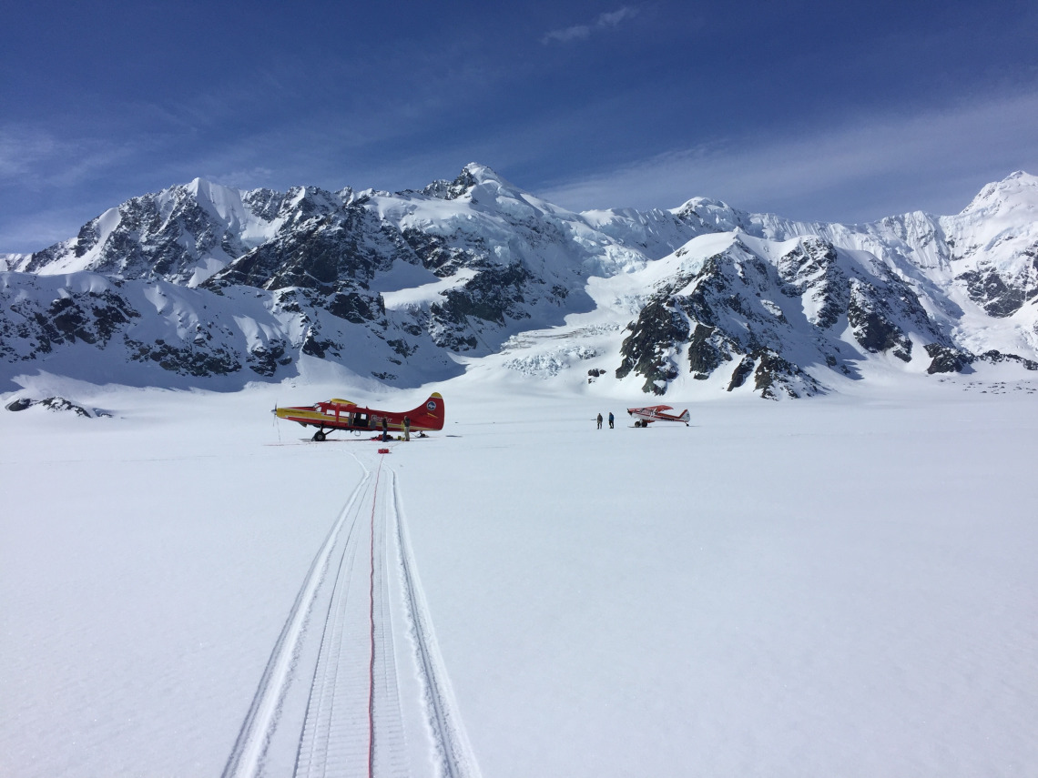
We have also started a new project on Malaspina Glacier in southeast Alaska, the world's largest piedmont glacier, that combines surface, airborne, and satellite observations in support of a modeling effort to predict how Malaspina will respond to encroaching ocean waters due to rapidly degrading ice-cored forelands.
GoPro time lapse of a flight from Yakutat, AK over Malaspina Glacier and past Mt. Saint Elias
While ice loss rates are higher for glaciers in Alaska than anywhere else in the world (Hugonnet et al., 2021), regional ice thickness remains poorly constrained. As part of NASA's Operation IceBridge, the TAPIR group has acquired airborne radar sounding data data over glaciers throughout Alaska since 2015 in conjunction with collaborators from the University of Alaska, Fairbanks. This work has involved the development of an evolution of radar systems, with the latest being the Arizona Radio Echo Sounder (ARES), a chirped system operating at a center frequency of either 2.5 or 5 MHz. Following radar data processing, radar profiles are investigated for the presence of glacier bed returns. If bed returns are detected, they are manually digitized allowing for measurements of ice thickness.
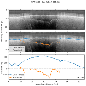
Example radar sounding profile across Malaspina Glacier, AK. Glacier surface in blue, glacier bed in orange.
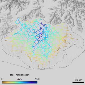
Measurements of ice thickness for Malaspina Glacier, AK.
Tober et al., 2022
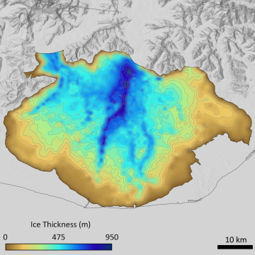
Interpolated ice thickness for Malaspina Glacier, AK.
Tober et al., 2022
In addition to ice thickness, we measure snow accumulation to constrain the incoming mass to glacier systems. This work is focused on major glaciers in the St. Elias Mountains in Southeast Alaska, including the Seward Glacier which feeds the Sit' Tlein Glacier. Snow accumulation is mainly derived from airborne 2-6 GHz snow radar developed by CReSIS (University of Kansas). A May 2023 field season collaboration between University of Alaska, University of Montana, University of Maine, University of Kansas, and University of Arizona collected data from the airborne snow radar, surface coupled GSSI 400 MHz and 200 MHz radars, and snow pits and cores as ground truths. Reflectors in the radar data are manually digitized and converted to snow accumulation amounts using 2023 ground truths and other ground truths through the St. Elias Mountains and Coastal Alaska.

2023: The team taking a break from skiing with the shallow radar system. The shallow radar is in the blue sled at the back of the rope team.
Michael Daniel
NASA:
- Operation IceBridge (NASA Award: NNX16AC32G; Jack Holt, CO-I)
- A New Regional View of Alaskan Glaciers: Bed Elevation, Ice Thickness, and Flux (NASA FINESST; Future Investigator, Brandon Tober)
NSF:
- The demise of the world's largest piedmont glacier (NSF Award: 1929566; Jack Holt, CO-I)